Birth and Re-birth
The ‘birth’ of a river suggests its source, the place from which it all began. This is
precisely what Tiziana and Gianni Baldizzone meant in their colourful book on the
Brahmaputra.
This would otherwise imply that the river ‘grows’ and then dies out of ‘old
age,’ something the two Italian authors could not help avoiding. But this is one way of
looking at the birth. In a region like South Asia which prides on the idea of re-birth,
things may not be so uncomplicated and linear. Here the idea would be to see the ‘birth’
of the Yarlung Tsangpo-Brahmaputra-Jamuna-Meghna in every point of the river, indeed,
not only with respect to its geo-territorial naming, that is, within China, India and
Bangladesh, but also with respect to its transformation, for instance, from a male deity
called the Brahmaputra to a female deity called the Jamuna. Moreover, less than 20
percent of the water of the Brahmaputra flows from the Yarlung Tsangpo, the bulk of the
water it gets from the heavy rainfall in the Assam region. The Yarlung
Tsangpo-Brahmaputra-Jamuna-Meghna otherwise gets re-born at every stage of its long,
tumultuous journey.
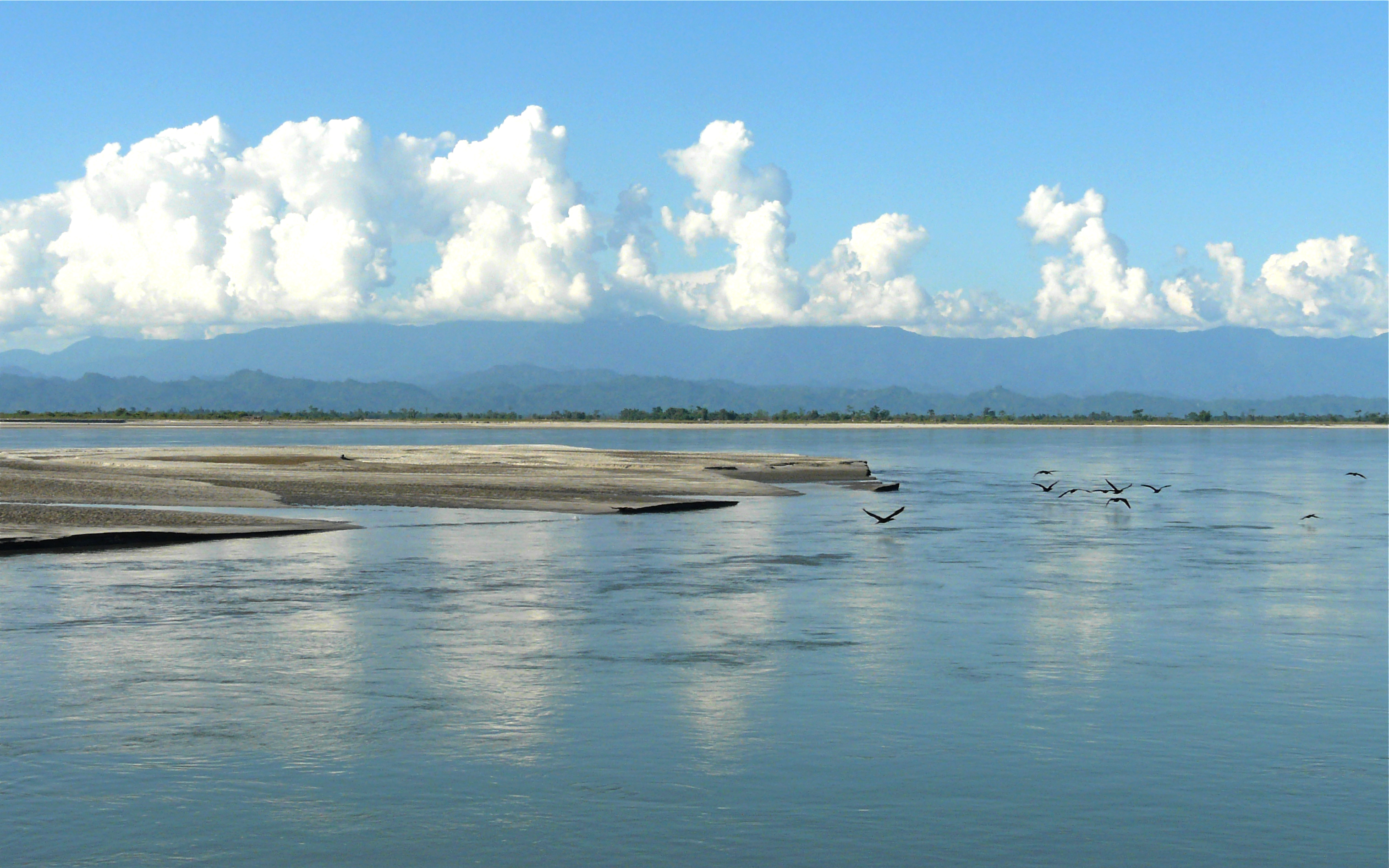
Yarlung Tsangpo-Brahmaputra-Jamuna-Meghna - one river with several names, flowing through
three countries, many nationalities and touching the minds and bodies of millions of people.
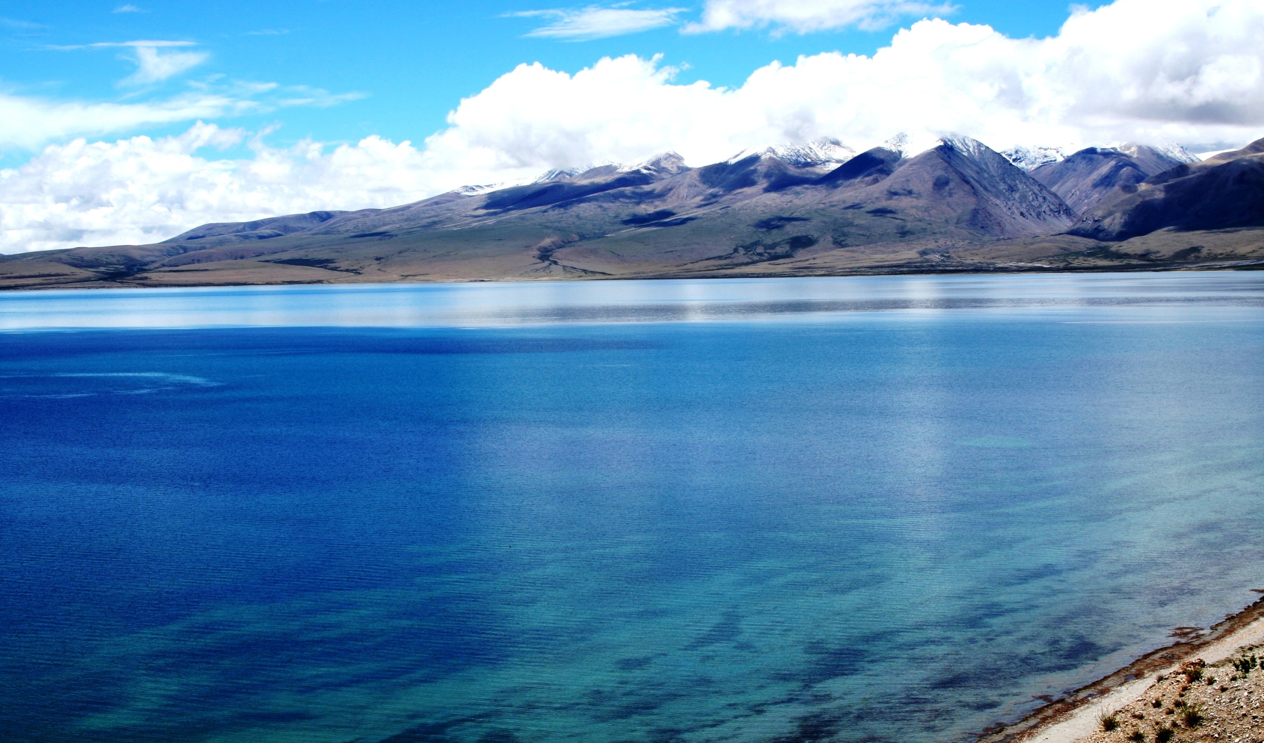
Originating in the mountain fastnesses and frozen high plateau of Tibet, near the great
Hindu, Buddhist, Jaina and Bonpo pilgrimage sites of Mansarovar Lake and Mt. Kailash – the
abode of the Gods - the Yarlung Tsangpo-Brahmaputra-Jamuna-Meghna - is life-giver and
destroyer. The vast river is one of the greatest waterways of the world, comparable to the
Yangtze Xiang, the Missisippi, the Amazon and the Nile. In every country through which it
flows, among the hundreds of national and ethnic groups that make its banks their home, the
cultures and traditions which it sustains in scores of communities spanning borders,
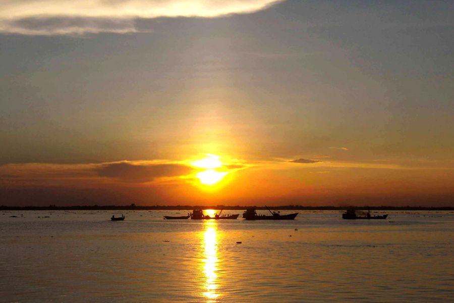
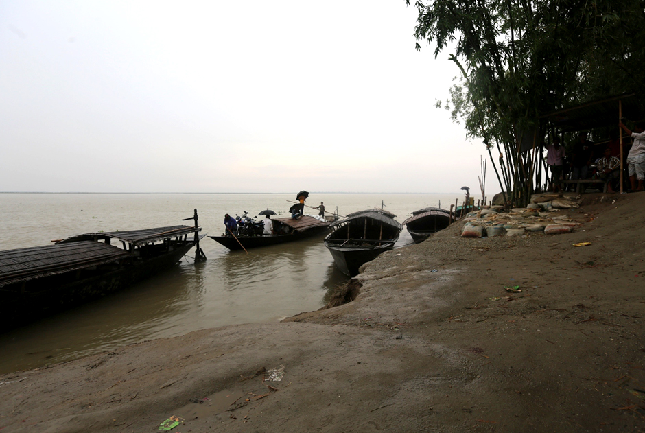
mountains and valley, the transport networks of great ferries, tiny dugouts, and the
ubiquitous ‘phut phutis’ (noisy rural country boats of Assam and Bangladesh) that it spawns,
the river leaves an indelible, internal imprint on human consciousness throughout its flow.
Notations
-
Yarlung Tsangpo in Tibet means ‘purifier.’ Some refer to it as the ‘mighty one,’ even
‘Great’ or ‘Large River.’ It is the mother river of Tibet. In Tibet, the river is also
called the Tsang-chu – ‘The river of Tsang.’ The river carries a volume of water greater
than the combined flow of the 20 largest rivers in Europe, a greater volume than any
river save the Amazon and the Congo.
-
The river originates from the tip Chema Yung Dung Glacier in western Tibet, but it grows
and sustains cultures and people along its 3,600 km journey to the Bay of Bengal.
-
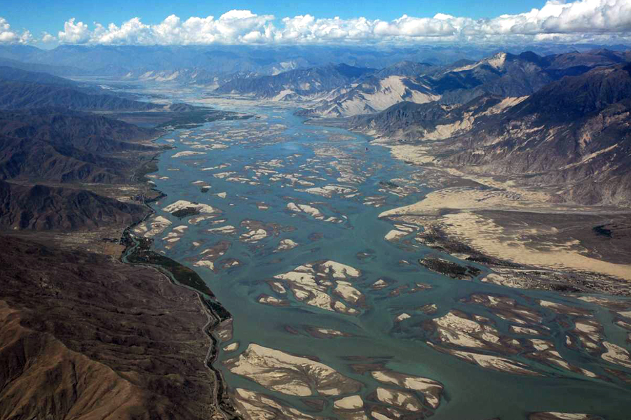
The constant process of birth, rebirth, growth and building is visible from the skies -
the alluvial fans of the Yarlung Tsangpo sweep south, east and west from the points at
which it enters the Bay of Bengal.
-
The rivers from the Himalayan ranges, in fact, bring down about 1400 million tons of
silt annually to deposit over the flood plains and into the Bay of Bengal. The rate of
sediment flow is high in the Brahmaputra-Jamuna, and this is why the latter is called a
braided river. This river carries everyday nearly 8.5 million metric tons of
sediment/silt. In fact, in some calculations the Yarlung
Tsangpo-Brahmaputra-Jamuna-Meghna with 540 million tons ranks 4th in the world when it
comes to the annual sediment discharge into the ocean, while in some other calculations
the Yarlung Tsangpo-Brahmaputra-Jamuna-Meghna alone has the distinction of being the
river with the highest sediment yield (852.4 t/km2/y) in the world.
-
Despite the vileness of human interventions, pollution, ambition and construction
Yarlung Tsangpo-Brahmaputra-Jamuna-Meghna continue to sustain the people who live all
along its course providing food, communications and beauty. Thus at every point along
its course individuals and communities grow, flourish and fade—symbolizing the entire
human cycle of birth and rebirth.
-
The Hindu Kush-Himalayan region spans an area of more than 4.3 million square kilometres
in Afghanistan, Bangladesh, Bhutan, China, India, Myanmar, Nepal, and Pakistan. This
region stores more snow and ice than anywhere else in the world outside the Polar
Regions, giving its name: ’The Third Pole‘. The Third Pole contains the world’s highest
mountains, including all 14 peaks above 8,000 metres, is the source of 10 major rivers,
and forms a formidable global ecological buffer.
-
The Tibetan Plateau, the high and low Himalayas as far as the Assam valley and plains
were formed as the Asian and European land plates clashed against each other creating
massive tsunamis and earthquakes and causing surface of the earth to buckle.
-
A sea occupied much of what is Assam today and the then existing Indian land mass was
known as Gondwanaland. Mountain building movements later created a further divide,
raising the centre and separating it into an Assam Basin and a Burmese Basin.
-
The Chang Tang, or great plateau - The drainage here is internal with short rivers
ending in lakes which, having no outlet, are brackish. The climate is severe and dry,
with salt often present in the soil. Chang Tang is thus virtually a desert with almost
no woody plants and very few flowering plants of any sort.
-
The Outer Plateau - This is the point of outward flow of water towards the sea. The land
gradually becomes more fertile from this point onwards. Most of the Tibetan towns like
Lhasa and Gyantse are situated on the outer plateau. The climate here is milder than in
the Chang Tang with varied alpine vegetation, though no forests can be found in the
region and most trees are confined to the banks of the river courses.
-
The River Gorge Country - The streams that flow outwards from the Chang Tang have
scooped shallow valleys for themselves. However, in order to escape the plateau and
reach the plains below, they have to cut their way through the high containing wall,
thereby giving rise to the river gorge country. The altitude varies greatly within a few
miles thereby changing the climate from warm temperate to cold temperate, but the
atmosphere is always moister than on the plateau and precipitation is greater.
-
Along its course the mighty Brahmaputra passes through the Tibet Autonomous Region of
China, the Indian states of Arunachal Pradesh and Assam, and Bangladesh. For most of its
length, the river serves as an important inland waterway; it is not, however, navigable
between the mountains of Tibet and the plains of India. In its lower course the river is
both a creator and a destroyer—depositing huge quantities of fertile alluvial soil but
also causing disastrous and frequent floods.
-
After passing Pi (Pe) in Tibet, the river turns suddenly to the north and northeast and
cuts a course through a succession of great narrow gorges between the mountainous
massifs of Gyala Peri and Namjagbarwa (Namcha Barwa) in a series of rapids and cascades.
-
It turns south and southwest and flows through a deep gorge (the “Grand Canyon” of the
Tsangpo) across the eastern extremity of the Himalayas with canyon walls that extend
upward for 5,000 metres and more on each side. During that stretch the river enters
northern Arunachal Pradesh- a state in northeastern India, where it is known as the
Dihang better known as the Siang and turns more south.
-
The Siang, winding out of the mountains, swings southeast and descends into a low-lying
basin as it enters Assam. Just west of the town of Sadiya, the river again turns to the
southwest and is joined by two mountain streams, the Lohit and the Dibang. Below that
confluence, about 1,450 km from the Bay of Bengal, the river becomes known
conventionally as the Brahmaputra (“Son of Brahma”) and also as the Lohit or Luit or
Lohitya.
-
In Assam the river is mighty, even in the dry season, and during the rains its banks are
more than 15-18 kms apart. As the river follows its braided 700-km course through the
valley, it receives several rapidly rushing Himalayan streams, including the Subansiri,
Kameng, Jiabhoreli, Dhansiri, Manas, Champamati, Saralbhanga, and Sankosh rivers.
-
The main tributaries from the hills and from the plateau to the south are the Burhi
Dihing, the Disang, the Dikhu, and the Kopili. The Brahmaputra plunges into the plains
of Bangladesh after a major turn around the Garo Hills below Dhubri, Assam.
-
Some of the important rivers of Brahmaputra basin are Siang, Subansiri, Kameng or Jai
Bhoroli, Dhansiri, Buri Dehing, Kopili, Manas, Jaldhaka, Torsa, and Teesta.
Table 1
Topographic Distribution of Brahmaputra Basin Area
| Sl.No. |
Nature of Topography |
Basin Area Under the Topography (sq.km.) |
Percentage of total basin area |
Geographical Location |
| 1. |
High Tibetan Plateau |
293,000 |
50.5 |
Southern part of the Tibet Autonomous Region (TAR) |
| 1. |
High Tibetan Plateau |
293,000 |
50.5 |
Southern part of the Tibet Autonomous Region (TAR) |
| 2. |
High Himalayan Mountains |
137,050 |
23.6 |
Part of the kingdom of Bhutan and of 3 states of India: Arunachal Pradesh, West Bengal and
Sikkim
|
| 3. |
Brahmaputra Valley |
56,200 |
90.7 |
Part of Assam state, India |
| 4. |
Lower (Assam) Mountainous Region |
37,200 |
6.4 |
Part of 3 states of India: Nagaland, Assam and Meghalaya |
| 5. |
Plains |
56,550 |
9.8 |
Part of 2 plains district of West Bengal (India) and part of Bangladesh |
| 6. |
Coastal Region |
Negligible |
|
Coastal region of Bangladesh |
-
The combined alluvium that has flowed through the Brahmaputra-Jamuna-Meghna for years created Bangladesh. Therefore,
these rivers have played a significant role in the formation of this land area. During this process numerous
tributaries, canals, wetlands and haors have been formed. Therefore the rivers are intricately linked with the life
and living of people residing in this region.
-
Ganga-Padma and Brahmaputra-Jamuna outpours to Bay of Bengal via Meghna and is the largest source of fresh water in
Bangladesh. The yearly water flows of these rivers are 1200 billion cubic meters and sediment/silt deposits are
1.50-2.50 billion ton.
-
Nearly 3,400 cubic meter of water is outpoured to Bay of Bengal by these rivers every day. This amount is 3.9 times
higher than the average water obtained from daily rainfall.
-
Rivers can be classified either geographically (tributary or distributaries) or on the basis of navigability. There
is also scientific classification of rivers that centers on the ability of the river to be utilized in
multi-dimensional welfare of humanity. Depending on utilization capacity, Teesta and Meghna are more important than
Brahmaputra and Padma since these rivers can be used for power generation and as permanent water ways.
-
The river Brahmaputra, third largest in the world enters Bangladesh from the city of Dhubri to the north. Then
Brahmaputra flows through the Kurigram district of Bangladesh.
-
Jamuna is the main distributor channel of Brahmaputra in Bangladesh where it flows for 337 km.
-
In its course southward, the Brahmaputra-Jamuna joins many tributaries and leaves many distributaries. They are
expanded all over the country like a network of rivers. On the right bank there are tributaries like the Gadaghar,
Dudhkumar, Dharla and Teesta. On the left bank there is Jiinjiram. The Brahmaputra’s tributaries have their own
streams like, Teesta have three streams namely Atrai, Karatoya and Punarbhaba entering Bangladesh at Kaunia to meet
Brahmaputa-Jamuna at Chilmari. Then there is Karotoya River, once the main stream of Teesta, is another tributary
with five streams—Dinajpur-Karotoya; Atrai-Gur; Rangpur-Karotoya; Bagura-Karotoya; Pabna-Karotoya. Then there is
Dharla River that flows parallel to Teesta and meets Brahmaputra.
Table 2
A flow chart showing the course of Brahmaputra-Jamuna River
| Right Bank |
The Brahmaputra River |
Left Bank |
|
Kachhakata |
|
| Dudhkumar (inflow) |
Noonkhawa |
|
| Dharla (inflow) |
Mogalbaccha |
|
| Teesta (inflow) |
Chilmari |
(inflow) Jinjiram |
| Jamuna (outflow) |
Bahadurabad |
|
| Jhenai (outflow) |
Jamalpur |
|
| Sirkhali (outflow) |
Mymensingh |
|
|
Hossainpur |
(outflow) Narasunda |
| Banar (outflow) |
Kapasia |
|
| Sitalikkhya (outflow) |
Monohardi |
(outflow) Kuri gang |
| Arial Khan (outflow) |
Char Mandalia, Monocharci |
|
|
Bhairab |
|
|
Joins Meghna River |
|
Source: Extracted from M. Inamul Haque, Water Resources Management in Bangladesh, P.67.
Table 3
A flow chart showing the course of Padma from Aricha where it meets Jamuna and outflows to Meghna at Chandpur
| Right Bank |
The Ganga-Padma River |
Left Bank |
|
Aricha |
(inflow) Jamuna |
| Madamkhali (outflow) |
Faridpur |
|
| Arial Khan (outflow) |
Sadarpur |
|
| Arial Khan (outflow) |
Chandpur |
|
|
Meets Meghna River |
|
Source: Extracted from M. Inamul Haque, Water Resources Management in Bangladesh, P.67.
-
Meghna river meets Old Brahmaputra downstream of Bhairab Bazar whose first tributary
on the left bank is Titas River and the second one is Gomti River. There are also
other branches. Dhanagoda river, Dakatia river, Nayabhangi river, Dharmaji river
and Tentulia river are the distributaries of Meghna.
Table 4
A flow chart showing the course of Meghna from Chandpur when it meets Padma
| Right Bank |
The Meghna River |
Left Bank |
| Padma (inflows) |
Chandpur |
(inflows) Dakatia |
| Jayanti (outflows) |
Goshair Haat |
|
| Dharmajani (outflows) |
Hizla |
|
|
Lakshmipur |
(inflows) Rahmatkhali |
| Tentulia (outflows) |
Ilisha |
|
|
Boyer char |
(inflows) Bagardona |
| Shahbajpur (outflows) |
Hatia |
|
|
Bay of Bengal |
|
Source: Extracted from M. Inamul Haque, Water Resources Management in Bangladesh, P.67.
-
Brahmaputra-Jamuna is the second largest river of Bangladesh. Brahmaputra previously
flowed through a different course. However, it has not changed its course in the
hilly areas. But in the plain lands it has changed its course more than once. Before
the 17th century, Old Brahmaputra used to flow through Bhairab Bazar bypassing Dhaka
district to meet the Surma-Meghna joint flow. This combined flow has been marked as
Meghna in the map of Major Rennel.
-
According to the American Society of Civil Engineering, several thousand years back
Brahmaputra out flowed to the China Sea after crossing Tibet. In the age of
Buddhism, it changed to its present course and started to outflow in Bay of Bengal.
Around 200 years back followed by an earthquake (1784) in Bangladesh, Brahmaputra
changed its course dividing into two streams. One stream is Jamuna and the other is
Old Brahmaputra.
-
Other sources indicate that, while entering Bangladesh, Brahmaputra used to flow
from the West at Garo Mountains passing across Dewanganj and then flowing southeast
touching Jamalpur, Maymensingh and Madhupur forest areas.
-
During the latest shift of course, Jamuna has turned into the main course and
distributaries of the previous course like the Narasunda River, Kharia, Sowai and
Kachamatia have dried up.
-
Along the lower courses of the Ganges and Brahmaputra and along the Meghna, the land
undergoes constant erosion and deposition of silt because of the shifts and changes
in these active rivers. Vast areas are subject to inundation during the wet monsoon
months. Islands and sizable newly deposited lands (chars) in the river appear and
disappear seasonally. The chars are valuable to the economy of Bangladesh as
additional cultivable areas.
-
The total basin area of Brahmaputra in Bangladesh is 42,000 sq. km. The total
catchment area of this river till Aricha is nearly 5, 80,140 sq km. It is called
braided river because the rate of sediment flow in this river is high. Everyday
nearly 8.50 million metric ton of sediment/silt is carried away by this river.
-
Districts that falls under catchment area of Brahmaputra-Jamuna are Panchagarh,
Thakurgaon, Dinajpur, Nilfamari, Rangpur, Lalmonirhat, Kurigram, Gaibandha, Naogaon,
Bagura, Jaypurhat, Sirajganj, Jamalpur, Tangail, Maymensingh(south), Manikgonj,
Gazipur, Norshingdi, Dhaka, Narayanganj and Munshiganj.
-
The total basin area of Meghna in Bangladesh is 24370 sq km and it flows through the
following districts-Sherpur, Mymensingh (North), Netrokona, Kishoreganj, Sunamganj,
Sylhet, Habiganj, Moulovibazar, Brahmanbaria, Comilla, Chandpur, Lakkhipur and
Noakhali.
 Yarlung Tsangpo-Brahmaputra-Jamuna-Meghna - one river with several names, flowing through
three countries, many nationalities and touching the minds and bodies of millions of people.
Originating in the mountain fastnesses and frozen high plateau of Tibet, near the great
Hindu, Buddhist, Jaina and Bonpo pilgrimage sites of Mansarovar Lake and Mt. Kailash – the
abode of the Gods - the Yarlung Tsangpo-Brahmaputra-Jamuna-Meghna - is life-giver and
destroyer. The vast river is one of the greatest waterways of the world, comparable to the
Yangtze Xiang, the Missisippi, the Amazon and the Nile. In every country through which it
flows, among the hundreds of national and ethnic groups that make its banks their home, the
cultures and traditions which it sustains in scores of communities spanning borders,
mountains and valley, the transport networks of great ferries, tiny dugouts, and the
ubiquitous ‘phut phutis’ (noisy rural country boats of Assam and Bangladesh) that it spawns,
the river leaves an indelible, internal imprint on human consciousness throughout its flow.
Yarlung Tsangpo-Brahmaputra-Jamuna-Meghna - one river with several names, flowing through
three countries, many nationalities and touching the minds and bodies of millions of people.
Originating in the mountain fastnesses and frozen high plateau of Tibet, near the great
Hindu, Buddhist, Jaina and Bonpo pilgrimage sites of Mansarovar Lake and Mt. Kailash – the
abode of the Gods - the Yarlung Tsangpo-Brahmaputra-Jamuna-Meghna - is life-giver and
destroyer. The vast river is one of the greatest waterways of the world, comparable to the
Yangtze Xiang, the Missisippi, the Amazon and the Nile. In every country through which it
flows, among the hundreds of national and ethnic groups that make its banks their home, the
cultures and traditions which it sustains in scores of communities spanning borders,
mountains and valley, the transport networks of great ferries, tiny dugouts, and the
ubiquitous ‘phut phutis’ (noisy rural country boats of Assam and Bangladesh) that it spawns,
the river leaves an indelible, internal imprint on human consciousness throughout its flow.
 The combined alluvium that has flowed through the Brahmaputra-Jamuna-Meghna for years created Bangladesh. Therefore,
these rivers have played a significant role in the formation of this land area. During this process numerous
tributaries, canals, wetlands and haors have been formed. Therefore the rivers are intricately linked with the life
and living of people residing in this region.
The combined alluvium that has flowed through the Brahmaputra-Jamuna-Meghna for years created Bangladesh. Therefore,
these rivers have played a significant role in the formation of this land area. During this process numerous
tributaries, canals, wetlands and haors have been formed. Therefore the rivers are intricately linked with the life
and living of people residing in this region.
 Meghna river meets Old Brahmaputra downstream of Bhairab Bazar whose first tributary
on the left bank is Titas River and the second one is Gomti River. There are also
other branches. Dhanagoda river, Dakatia river, Nayabhangi river, Dharmaji river
and Tentulia river are the distributaries of Meghna.
Table 4
Meghna river meets Old Brahmaputra downstream of Bhairab Bazar whose first tributary
on the left bank is Titas River and the second one is Gomti River. There are also
other branches. Dhanagoda river, Dakatia river, Nayabhangi river, Dharmaji river
and Tentulia river are the distributaries of Meghna.
Table 4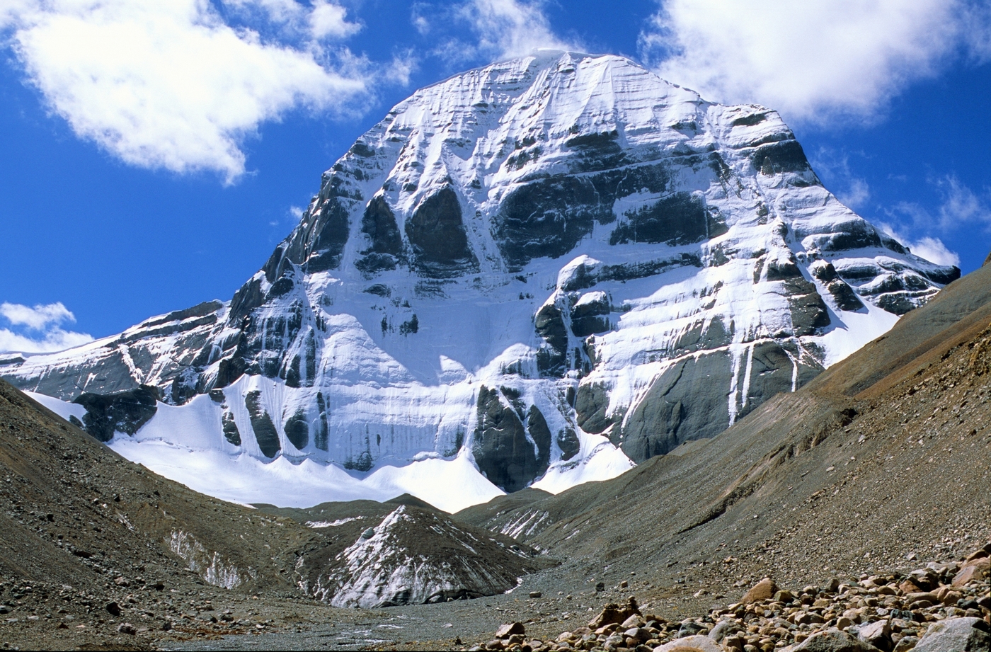 According to the American Society of Civil Engineering, several thousand years back
Brahmaputra out flowed to the China Sea after crossing Tibet. In the age of
Buddhism, it changed to its present course and started to outflow in Bay of Bengal.
Around 200 years back followed by an earthquake (1784) in Bangladesh, Brahmaputra
changed its course dividing into two streams. One stream is Jamuna and the other is
Old Brahmaputra.
According to the American Society of Civil Engineering, several thousand years back
Brahmaputra out flowed to the China Sea after crossing Tibet. In the age of
Buddhism, it changed to its present course and started to outflow in Bay of Bengal.
Around 200 years back followed by an earthquake (1784) in Bangladesh, Brahmaputra
changed its course dividing into two streams. One stream is Jamuna and the other is
Old Brahmaputra.
 Districts that falls under catchment area of Brahmaputra-Jamuna are Panchagarh,
Thakurgaon, Dinajpur, Nilfamari, Rangpur, Lalmonirhat, Kurigram, Gaibandha, Naogaon,
Bagura, Jaypurhat, Sirajganj, Jamalpur, Tangail, Maymensingh(south), Manikgonj,
Gazipur, Norshingdi, Dhaka, Narayanganj and Munshiganj.
Districts that falls under catchment area of Brahmaputra-Jamuna are Panchagarh,
Thakurgaon, Dinajpur, Nilfamari, Rangpur, Lalmonirhat, Kurigram, Gaibandha, Naogaon,
Bagura, Jaypurhat, Sirajganj, Jamalpur, Tangail, Maymensingh(south), Manikgonj,
Gazipur, Norshingdi, Dhaka, Narayanganj and Munshiganj.